The data you need to keep your communities safe.
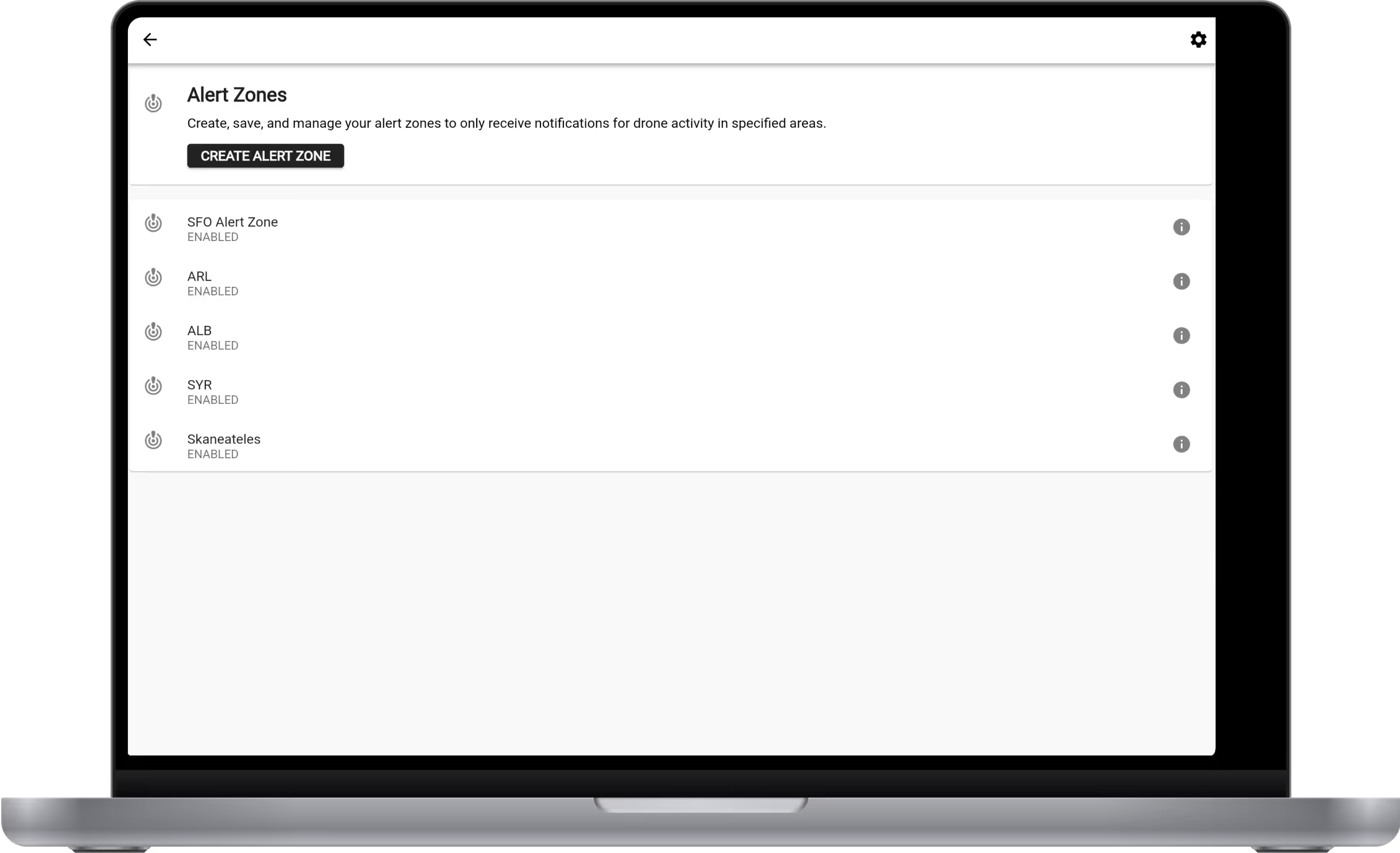
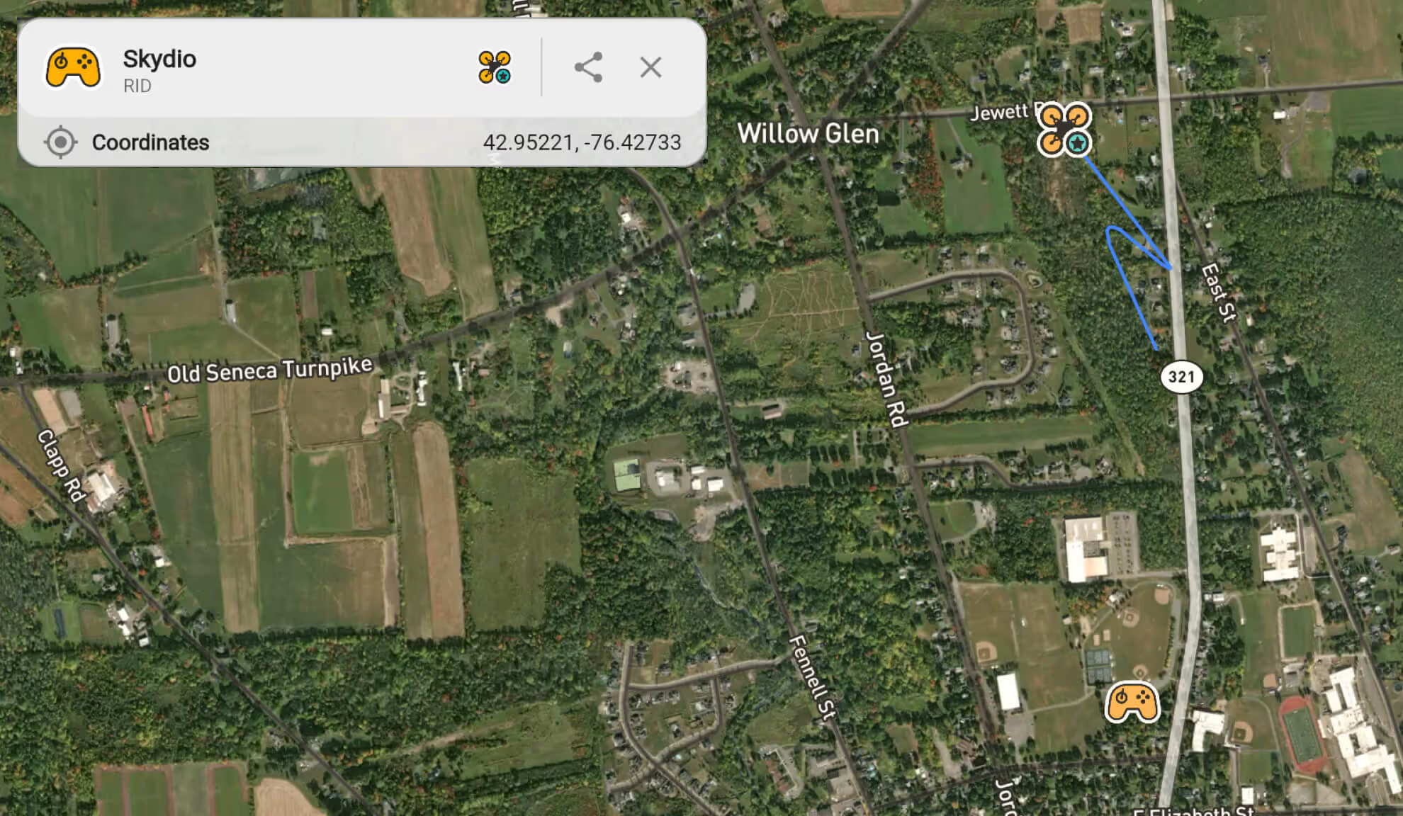
A laptop displaying Alert Zones from Hidden Level
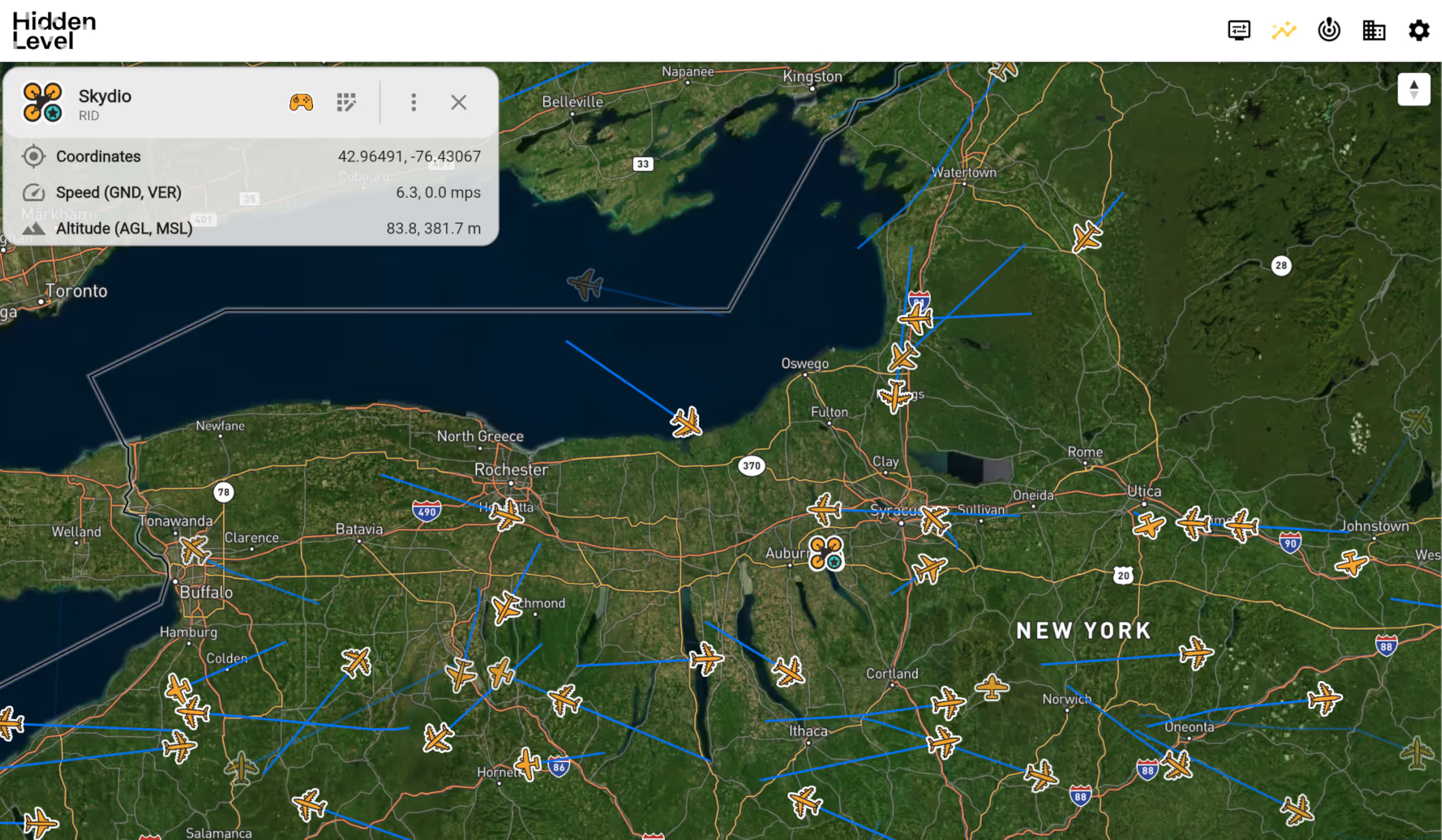
A laptop displaying a flight radar
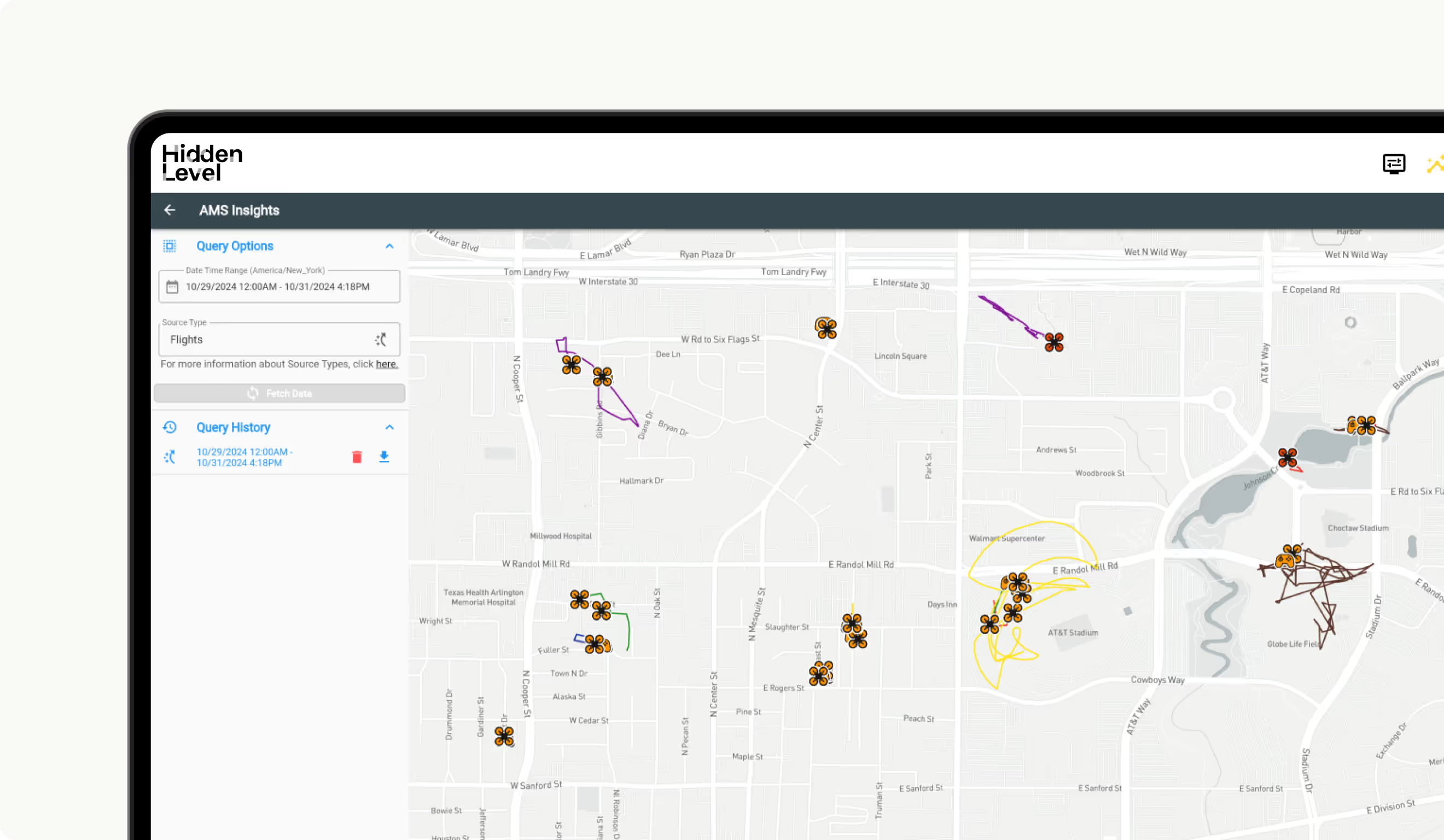
A laptop displaying Hidden Level dashboard
Detect, track, and respond to RF threats faster and more reliably with Hidden Level’s global sensor network. With the ability to sense crewed and uncrewed aerial activity, spectral weather, and more, you’ll get the data you need to drive better decisions.

detect airborne crafts. and make confident decisions quickly.

Know what’s in the air. Track all crewed and uncrewed aerial activity at low altitude. Even dark targets.

Identify operator location. Pinpoint precise operator location with 3D accuracy.

Tighten your security. Leverage historical data for predictive security that keeps you ahead of threats.

Create alert zones. Create, save, and manage your alert zones to only receive notifications for drone activity in specified areas.

Receive customized alerts. Empower operators with clear decision points while reducing response times.

Stay informed. Customize reports based on time of day analytics, weekly roll-ups, activity heatmaps and more.

Instant data access. Open, interoperable architecture. Flexible subscription-based plans. Encrypted, restricted, secure. This is how you secure your airspace, easily.

support BVLOS operations.

Fly beyond visual line of sight. By blanketing low-altitude airspace over vast geographic areas, Hidden Level provides the visibility and data you need for authorized BVLOS operations.

secure your airspace.

Protect the airspace around stadiums, airports, and VIP buildings, secure data centers from cyber-threats, prevent contraband drone deliveries to correctional facilities, and more.

key benefits of data as a service.

Get instant access

No wait time.
Get instant access to best-in-class global sensing data to drive better decisions.

Improve communication

Better coordination.
Work from a common operating picture to coordinate rapid, decisive action across multiple stakeholders.

Integrate Easily

Secure & seamless integration.
Integrate using our open API, secured by FIPS 140-2 compliant cryptography. Or use our turnkey web interface.

zero maintenance

Zero headache.
Get real-time, actionable data from a global sensor network that’s owned, operated, and maintained by Hidden Level.

Our global sensor network.
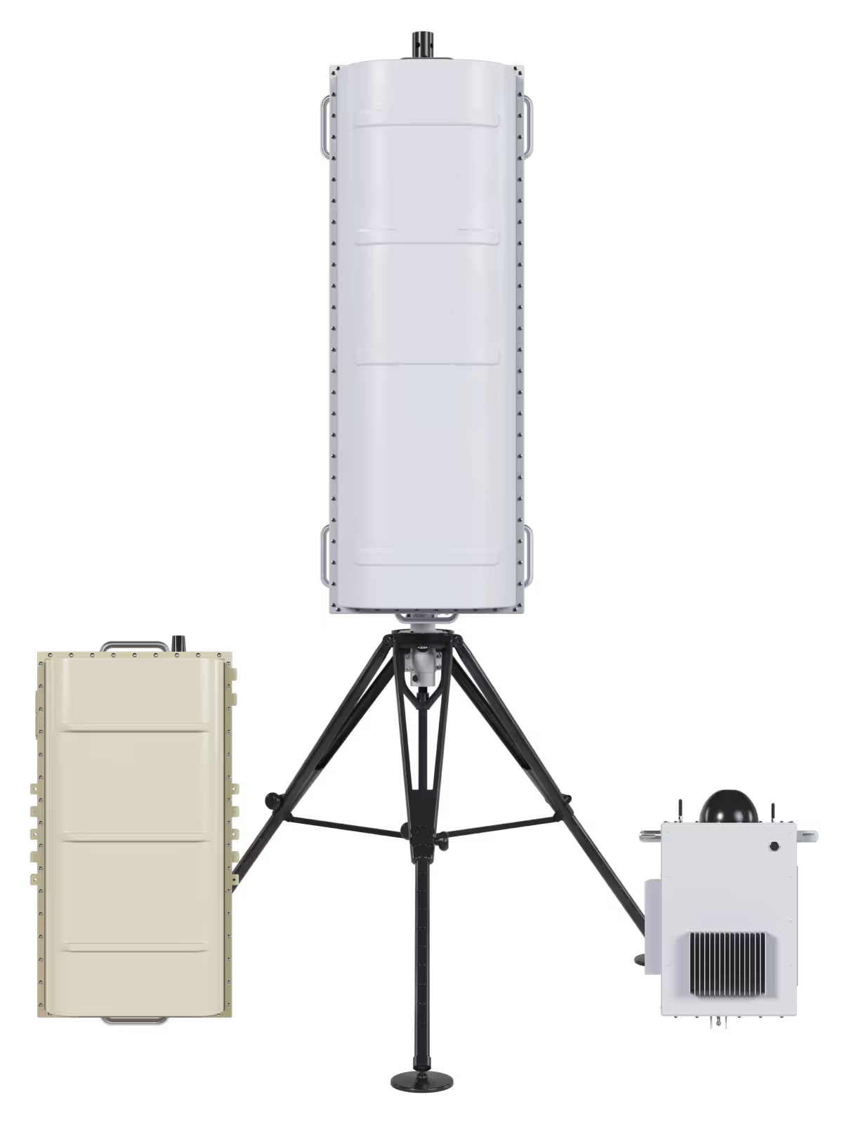
The best data. powered by the most advanced sensors.

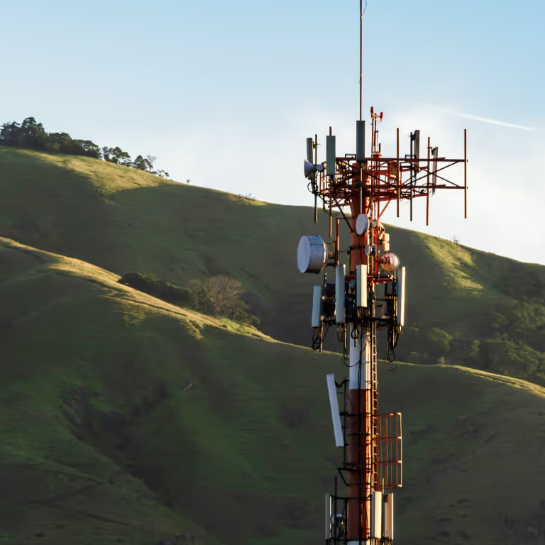
our sensors are imbedded in urban and rural areas across the globe to get you the data you need, easily.

Built to make a difference.

02

PARTNERING WITH THE FAA.

Case study.
Hidden Level deployed its sensor network at multiple airports to assist with planning for certifying, permitting, or authorizing UAS detection and mitigation technologies at airports around the country in accordance with Section 383 of the FAA Reauthorization Act.
01

SUPPORTING ARLINGTON PD.

Case Study.
Hidden Level deployed sensors to provide 24x7 UAS and UAS operator detection and tracking around the city’s most critical infrastructure and popular venues.
02

PARTNERING WITH THE FAA.

Case study.
Hidden Level deployed its sensor network at multiple airports to assist with planning for certifying, permitting, or authorizing UAS detection and mitigation technologies at airports around the country in accordance with Section 383 of the FAA Reauthorization Act.

QUESTIONS FROM CUSTOMERS LIKE YOU.

What is Data as a Service (DaaS), and how does it apply to CUAS?

DaaS is a cloud-based solution that allows users to access, manage, and analyze data in real-time without requiring extensive on-site, customer owned hardware. In CUAS systems, DaaS is used to provide continuous monitoring and threat detection in airspace, ensuring drones are tracked and mitigated effectively.

What are the benefits of using DaaS for airspace monitoring?

DaaS provides cost-effective, scalable, and low-maintenance solutions. It ensures that airspace monitoring systems remain up-to-date with no need for you to manage hardware upgrades, allows for instant deployment, and offers seamless integration with other platforms, making it a flexible and future-proof solution.

How does Hidden Level’s DaaS-powered airspace monitoring differ from other CUAS solutions?

Hidden Level’s solution offers comprehensive real-time coverage, instant identification of operator locations, and the ability to leverage both live and historical data. Additionally, it allows for easy integration with existing security systems, custom alerting zones, and no hardware maintenance costs.

How does Hidden Level’s custom zones and alerting system improve airspace security?

By allowing users to set up custom zones within their airspace, Hidden Level ensures that specific areas of concern are monitored closely. The alerting system notifies security teams in real-time when any unauthorized activity occurs in these zones, providing an additional layer of security.

What is the advantage of leveraging historical data in CUAS systems?

Analyzing historical airspace data allows security teams to identify patterns in drone activity, better predict future threats, and improve their mitigation strategies.

What is unique about our technology?

Hidden Level technology is purpose and custom-built from the ground up to be specifically adept at providing the detection and tracking of multiple types of targets using multiple types of algorithms in a single package. Sensors have continuous frequency coverage across a wide bandwidth, extending beyond the standard ISM bands.

Our processing is Software Defined and can be adapted rapidly as missions and threats evolve. The use of different and flexible detection and tracking modalities across the frequency range allow our systems to adapt to the environment in which they are used.

Our RF detection algorithms are not impacted by encrypted links and are Title 18 Privacy Compliant. Hidden Level sensors can detect all target types: Crewed and uncrewed, cooperative or non-cooperative, RF-emitting or RF-silent.

What are the data security controls?

Commercial data is hosted on Amazon Web Services. Access to these servers is controlled with a least-privilege paradigm, such as IP-address restrictions and multi-factor authentication via FIPS 186.5 compliant public/private key exchange. 

The AMS API is secured using TLS 1.3 which provides secure communication of data using exceptional cryptographic algorithms, advanced ciphers, and has functions to ensure data integrity while mitigating the risk of tampering. API access and authentication are controlled via user-specific API tokens.

How is the interface accessed?

Hidden Level provides multiple user interface options. Hidden Level can provide our internally developed display which consists of a modern web-based interface accessible from the internet as well as a mobile application version supported on iOS and Android devices. Alternatively, you can integrate into a GIS system of your choice via a secure API connection.

How do I integrate or ingest your data?

Integrate using our open API, secured by FIPS 140-2 compliant cryptography or use our turnkey web interface.