Thank you! Your submission has been received!
Oops! Something went wrong while submitting the form.
A stadium full of spectators
solution for Public Safety

Keep your communities safe.

Advanced UAS technology is fundamentally changing how we protect our venues, our borders, and our communities. Hidden Level’s sensor data enables life-saving drone operations like search and rescue, firefighting, and drone-as-first-responder, as well as protecting and deconflicting the airspace around stadiums, airports, and other critical infrastructure.

US FCC compliant. Encrypted, restricted, secure. Reduced operator burden. Interoperable, open architecture. Easy to acquire. This is how you bring the public peace of mind.

How we keep the public safe.

Support emergency responders.

Get the timely and accurate intel you need when lives are on the line. Hidden Level supports search and rescue operations, firefighting, and drone-as-first-responder operations.

Protect large public venues.

Keep crowds safe in stadiums, concert venues, and more.

Secure
airport airspace.

Detect unauthorized drones and their pilots to prevent costly delays and shutdowns.

Imbed with a mobile unit.

Get targeted intelligence from mobile units with sensors that are light-weight, energy efficient, and easy to install.

Designed to make your decisions clear.

Use our data

Powered by Hidden Level’s global sensor network.
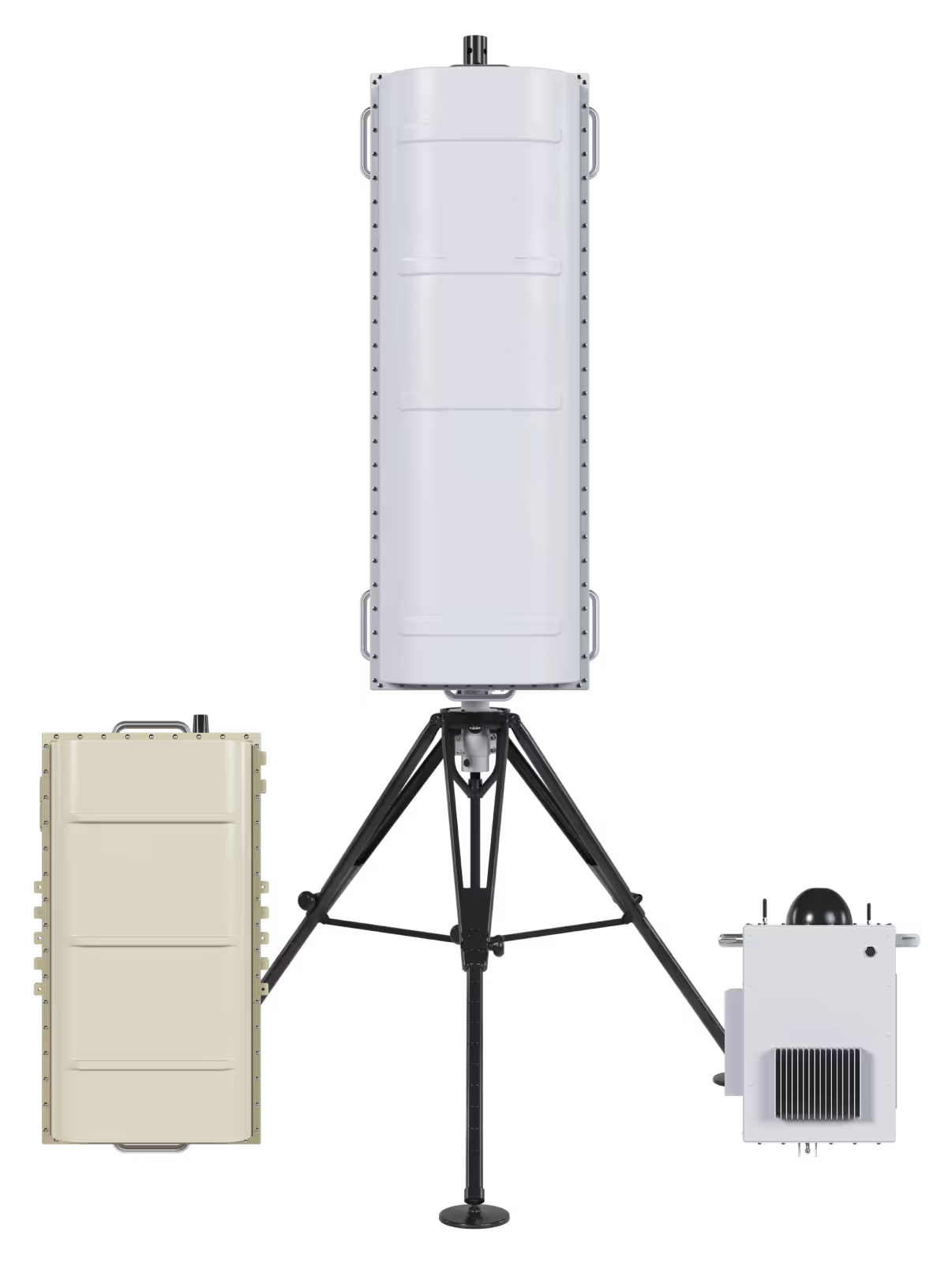
Gather your own data

Find the right sensor to meet your mission.

Designed to make your decisions clear.

Deploy.

Get reliable intel in any environment.
Deploy U.S. FCC compliant sensors anywhere from complex urban environments to rural areas. Or, use data from our global network of imbedded sensors to spot threats, sooner.

Integrate.

Unify your response.
Communicate and collaborate seamlessly with an open-API architecture that lets you integrate with any system and coordinate action across multiple agencies.

Detect.

Spot threats with zero interference.
Protect public venues, borders, and more. Track all crewed and uncrewed aircraft activity at low altitude. Hidden Level’s passive sensors provide remote visibility without disrupting existing operations.

Analyze.

Strengthen your defense.
Predict threats. Leverage historical data for predictive security that keeps you ahead of threats.
Drones, when piloted improperly, can create public safety issues during large public events in the Entertainment District. Hidden Level’s AMS gives us a tool to detect and deter possible dangerous and criminal activity during game days.
Al Jones
,
Chief of Police, Arlington, TX

BUILT TO PROTECT THE PUBLIC.

02

securing Syracuse airport with nuAir.

Case Study
Hidden Level deployed sensors to provide UAS detection capability in the BVLOS corridor and aggregated all airspace sensor data into a common operating picture for all partners.
01

Arlington
police dept.

Case Study
Hidden Level deployed sensors to provide 24x7 UAS and UAS operator detection and tracking around the city’s most critical infrastructure and popular venues.
02

Securing Syracuse airport with nuAir

Case Study
Hidden Level deployed sensors to provide UAS detection capability in the BVLOS corridor and aggregated all airspace sensor data into a common operating picture for all partners.

Questions from customers like you.

Do you detect beyond DJI?

Yes. Our solution is manufacturer agnostic and capable of detecting all types of drones including DIY and Wi-Fi.

How do you detect the operator?

By picking up the RF signals that the controller transmits to communicate with the drone, we can locate the operator.  Signal Detection: The drone controller sends commands to the drone through a radio signal, usually on specific frequencies like 2.4 GHz or 5.8 GHz, which are commonly used for remote control communications.  

Signal Analysis: The system analyzes the characteristics of the signal, such as frequency, signal strength, modulation type, and other patterns that positively match those used by drone controllers. Location Estimation: The system triangulates the signal source by measuring the angle of arrival (AOA) or time difference of arrival (TDOA) at each receiver to determine the approximate location of the drone controller / operator.

Does your system use demodulation?

Our system does not use demodulation. We assess the physical characteristics of the RF signal (protocol layer) to determine the type of craft (i.e. drone) and other location attributes like latitude, longitude, altitude, elevation, speed, etc.

How do you ensure FCC compliance?

The FCC (Federal Communications Commission) regulates the transmission of radio frequency signals to prevent interference with other communication systems, such as cellular networks, Wi-Fi, radio, and emergency services. Since our system relies on passive RF sensing, it does not actively transmit RF signals, only receives and analyzes ambient signals. This does not impact the licensed or unlicensed frequency bands managed by the FCC, making it exempt from the strict transmission regulations that apply to active RF devices like radars or Wi-Fi routers.

Where is your technology made?

Our technology is designed, developed, and manufactured in the US.

How does Hidden Level support BVLOS operations?

Beyond Visual Line of Sight (BVLOS) operations require advanced monitoring capabilities since operators cannot visually track drones. Hidden Level’s system, powered by DaaS, enhances situational awareness, providing continuous real-time data that supports these operations by keeping airspace safe and secure.

What is Data as a Service (DaaS), and how does it apply to CUAS?

DaaS is a cloud-based solution that allows users to access, manage, and analyze data in real-time without requiring extensive on-site, customer owned hardware. In CUAS systems, DaaS is used to provide continuous monitoring and threat detection in airspace, ensuring drones are tracked and mitigated effectively.

How is the interface accessed?

Hidden Level provides multiple user interface options. Hidden Level can provide our internally developed display which consists of a modern web-based interface accessible from the internet as well as a mobile application version supported on iOS and Android devices. Alternatively, you can integrate into a GIS system of your choice via a secure API connection.

How does Hidden Level’s DaaS-powered airspace monitoring differ from other CUAS solutions?

Hidden Level’s solution offers comprehensive real-time coverage, instant identification of operator locations, and the ability to leverage both live and historical data. Additionally, it allows for easy integration with existing security systems, custom alerting zones, and no hardware maintenance costs.

How does Hidden Level’s custom zones and alerting system improve airspace security?

By allowing users to set up custom zones within their airspace, Hidden Level ensures that specific areas of concern are monitored closely. The alerting system notifies security teams in real-time when any unauthorized activity occurs in these zones, providing an additional layer of security.