Next Generation Airspace Monitoring
Whether you are a stadium, airport, power plant, critical site or just a resident who wants to monitor drone activity around your address – we’ve got you covered.

Assessing the Threat
With initiatives like drone delivery coming to life and urban air mobility gaining traction, the worldwide commercial drone market is projected to double in the next 3 years.
Hidden Level is creating a future where privacy & safety are equally cared for as the skies become increasingly congested.
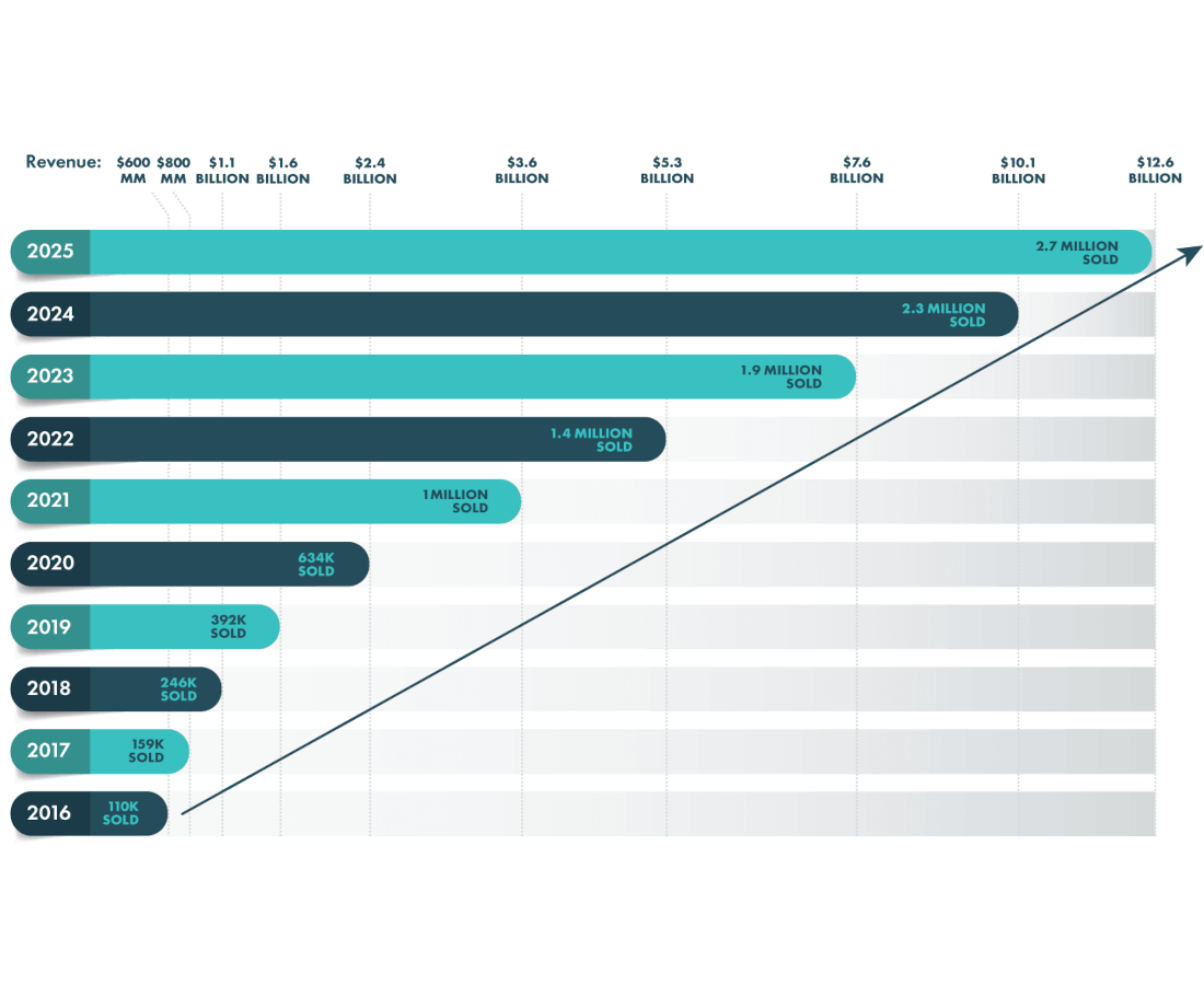
Thousands of drone incidents are reported each year in the United State alone. That number is sure to escalate as more & more drones enter our airspace. Drone threats occurs because the operator is careless, clueless of the rules or regulations or has criminal intent. Monitoring the airspace is a necessity to ensure safety.
6 TYPES OF CRIMINAL INTENT
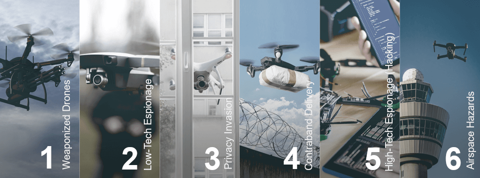

01
SaaS Deployment Model
No hardware to install, configure or maintain. All you need is a username and password to get customized access and automatic upgrades integrated into your GIS.

02
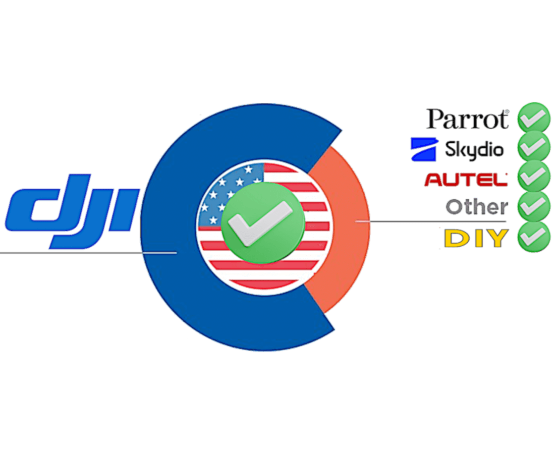
Drones Detected, Identified & Tracked
Some solutions only detect certain drone manufacturers while others only focus on specific RF Frequencies. Hidden Level frequency spectrum coverage (850MHz – 6GHz) extends beyond common RF bands, allowing for a broader detection capability to include all drones, even generic DIY.
03
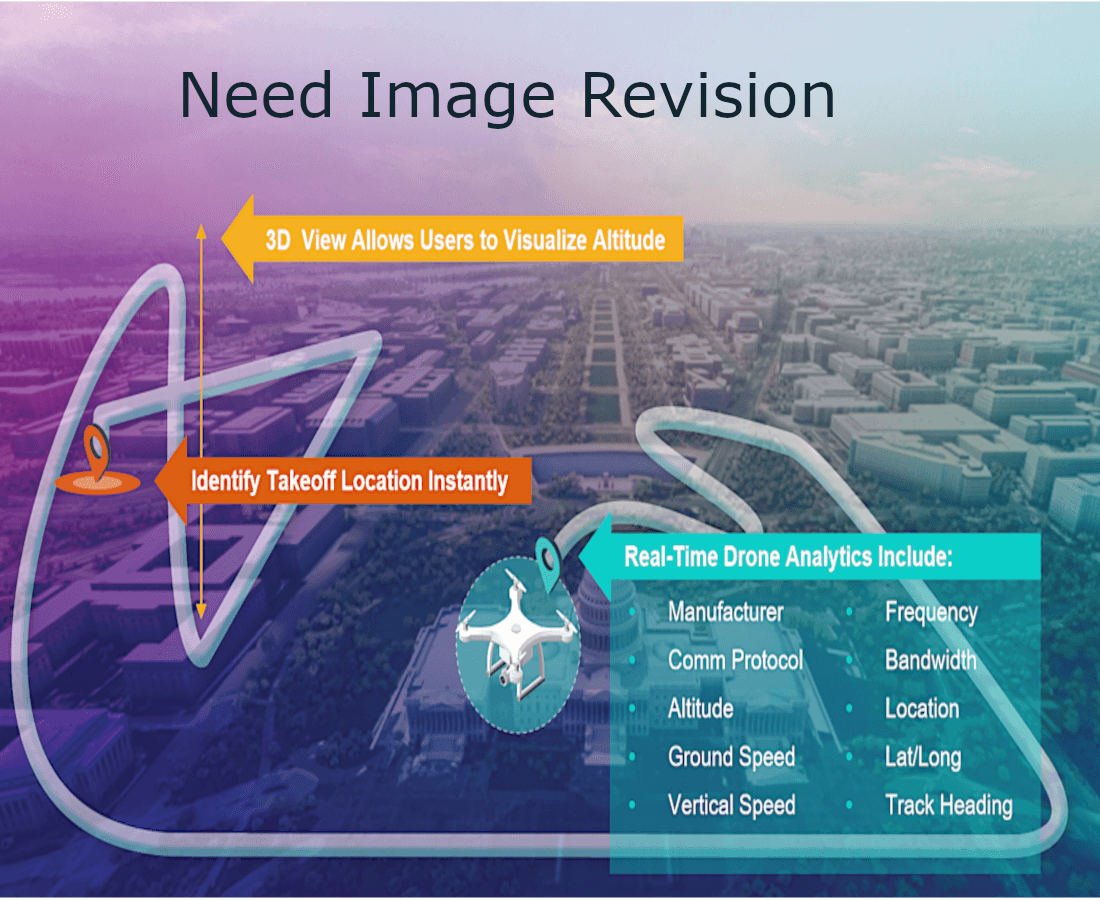
ID Take-Off Location – Maximum Early Warning
Point-based solutions do not have the range to detect drones until the threat is already of top of you, nor do they provide the Take Off Location (TOL) of the controller.
Hidden Level not only provides maximum early warning and preparedness, but also the specific location of the controller to allow clients the time to dispatch security personnel.
04
Title 18 Privacy Compliant
Other systems demodulate (hack) the signal to read the information in the data packets including craft identifier (serial number), location from GPS coordinates, and other information sent between craft and controller.
Hidden Level’s AMS assesses the physical characteristics of RF signals transmitted by UAS and the direction from which RF signals are emitted, only identifying the type and location of a UAS. It does not record or attempt to analyze the information transmitted by the RF signals, so it is Title 18 compliant.

05
AMS Insights
Powerful and customizable analytics including flight based analysis, time of day analysis, weekly roll-ups, activity heatmaps and manufacturer diversity.

Airspace Monitoring Service (AMS)
Built to address the challenges of today, designed to meet the opportunity of tomorrow.